777 873 281
Po - Čt 9-15h, Pátek 9-12h, So-Ne a státní svátky zavřeno
0
Žádné produkty
Bude determinováno
Doručení
0 Kč
DPH
0 Kč
Celkem
Ceny jsou s DPH
Produkt byl úspěšně přidán do nákupního košíku
Počet:
Celkem:
0 ks zboží.
1 produkt v košíku.
Celkem za produkty:(s DPH):
Celkem za doručení:(s DPH):
Bude determinováno
DPH:
0 Kč
Celkem(s DPH):
Výsledky vyhledávání geodézie
-
Topographic map background illustration of island hand drawn. Contour background design element thin wavy lines.Abstract concept image for background. Contours relief of mountains collection.#682218191

-
survey engineer in construction site use theodolite mark a concrete pile co ordinate#709850177

-
The space satellite collects data for reconnaissance. Visualization of a satellite against the background of the earth. Internet satellite flying in space in zero gravity. Observation from space.#668858086

-
Double exposer of constriction sector worker with a big copy space, Generative AI.#715254246

-
Vector landscape geodesy topography map background. Line texture pattern.#297141966

-
Topographic map background geographic line map with elevation assignments. Modern design with White background with topographic wavy pattern design.paper texture Imitation of a geographical map shades#697659729

-
Digital elevation model. GIS product made after proccesing aerial pictures. It shows excavation site with steep rock walls that was mapped from a drone#721639872
-
geodesy concept with pencil and calipers#80027616
-
Abstract topographic map landscape. Paper cutout style of mountain and river#670871125

-
modern concrete and steel building construction site#670778269

-
Civil engineer inspecting road construction work and supervising expressway project#667633722

-
Satellite above earth. Topographic surveys from space. Satellite geodetic research. Creation of topographic map of area. Nature view from quadrocopter. Land near forest. Satellite geodesy services#600398131

-
Theodolite measurement instrument outdoors#27725839

-
Special device (level) for surveyor builders, geodesy equipment close up. Outdoors, copy space.#253515360

-
Surveyor engineer at the geodetic device in the field. Carrying out geodetic and cadastral work, a business card for an engineer#540771943

-
Picture of construction engineer working on building site#179704423

-
civil engineer surveying a construction site generative ai#641499988

-
engineer site survey with laser tripod machine in site construction background#268869272

-
Surveyor’s telescope at new road construction site#157114730

-
Early morning light casts a golden hue on a surveyor telescope positioned at the edge of an active construction site#757559909

-
orange theodolite prism lies on a background geodetic maps of the area#97686091

-
Surveyor on green field#259413477

-
surveyor equipment outdoors#35219144

-
Double exposer of constriction sector worker with a big copy space, Generative AI.#715254685

-
Vector landscape geodesy topography map background. Line texture pattern.#297141925

-
Topographic map background geographic line map with elevation assignments. Modern design with White background with topographic wavy pattern design.paper texture Imitation of a geographical map shades#578388395

-
engineering instrument and construction industry#41468396

-
An inspector in a helmet uses a geodetic device to focus the terrain for future construction according to the project. World surveyors day concept.#737255640

-
Vector abstract topographic map for your design. Blueprint.#618248695
-
land surveying logo icon and vector#665439067

-
Theodolite transit equipment used by a surveyor when surveying a construction site outdoors#773272945

-
Surveyor with a tripod. Man surveyor on orange background. Man with optical level. Theodolite in hands of a surveyor. Collage with builder at work. Geodetic works. Employee of geodetic company#446939315

-
Surveyor builder Engineer with theodolite transit equipment at construction site outdoors during surveying work with generative ai#624068606

-
Surveyor engineers team wearing safety uniform,helmet and blueprint document checking inspection by theodolite to measurement position on railway construction site is industry transportation concept.#624081402

-
Surveyor engineer stands at the geodetic instrument. Geodetic and cadastral works#540463599

-
Modern Abstract Topographic map background with wave lines. Topographic map in contour black line on isolated white background. Vector illustration. paper texture Imitation of a geographical map shade#775987665

-
Picture of construction engineer working on building site#172653295

-
silhouette black man survey and civil engineer stand on ground w#100544269

-
Surveryors setting up real-time kinematic or RTK geodetic surveying equipment used in the field. A GNSS receiver, GPS rugged field controller and transceiver.#515979075

-
Construction Worker Using Theodolite Surveying Optical Instrument for Measuring Angles in Horizontal and Vertical Planes on Construction Site. Engineer and Architect Using Tablet Next to Surveyor.#378798094

-
Topographic map. Geographic contour map background. Vector illustration.#617898109

-
Devices for a geodesy#39840190
-
surveyor equipment theodolite at construction site#55375289

-
A surveyor builder engineer with theodolite transit equipment at construction site outdoors during surveying work.#681203935

-
Vector landscape geodesy topography map background. Line texture pattern.#297141943

-
Abstract background with Topographic map lines. Black and white seamless design. Geographic mountain relief. The concept of a conditional geography scheme and the terrain path. .Topographic background#545580948

-
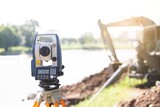
Theodolite in construction.To find accurate level values. In the background is the water pump and backhoe .#437072736
-
geodetic icon in 4 different styles such as filled, color, glyph, colorful, lineal color. set of vector for web, mobile, ui#602478937

-
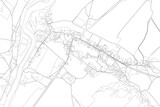
Part of urban plan of a town with river. Vector map.#658993851
-
Surveyor concept set. Land surveying technology, geodesy science#446094211