777 873 281
Po - Čt 9-15h, Pátek 9-12h, So-Ne a státní svátky zavřeno
0
Žádné produkty
Bude determinováno
Doručení
0 Kč
DPH
0 Kč
Celkem
Ceny jsou s DPH
Produkt byl úspěšně přidán do nákupního košíku
Počet:
Celkem:
0 ks zboží.
1 produkt v košíku.
Celkem za produkty:(s DPH):
Celkem za doručení:(s DPH):
Bude determinováno
DPH:
0 Kč
Celkem(s DPH):
Výsledky vyhledávání geodézie
-
Architecture model and plans#37071407

-
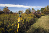
Theodolite measurement instrument outdoors#27725829

-
Theodolite set in the field#4946677
-
測量士#435224068

-
Vector contour topographic map background. Topography and geography map grid abstract backdrop. Business concept. Vector illustration#418776055

-
Heavy industry and security concept on blurred natural background. Civil engineer with theodolite crossing equipment at construction site outdoors. Big excavator in the background#785125300

-
Worker in a safety vest and hard hat is utilizing a surveying instrument to measure a construction#793360834

-
A satellite hovers in space, tracking our planet. It collects and transmits data, providing an Internet connection through modern technology. Space satellite, monitors and collects data#668858149

-
abstract landscape geodesy topography map background art line texture pattern, Desktop Wallpaper Backgrounds, Background HD For Designer#761011850

-
Important surveying on the construction site the foreman#143342267

-
3d rendered green topographic wireframe. mountain grid. A green fishing net is wrapped in a blue cloth.#763829019

-
Agricultural terraces in aerial GIS data development. Map made in 3d scanning by Lidar#721639421

-
Mining technician in the exploitation of a mine.#690300668

-
quadrocopter drone with remote control against colorfull sunset on river. close-up texture of waves on the river at sunset, colorful clouds on the sky over the morning river. majestic misty sunrise.#133634493

-
Engineers are inspecting road construction work.#782959671

-
Abstract topographic map landscape. Paper cutout style of mountain and river#670873323
-
White topography topology vector abstract background contour design#784327207

-
A black drone hovers over a golden wheat field in the rays of the setting sun. Concept: technologies in agriculture, the use of drones in agricultural technology and for crop monitoring.#764206903

-
Surveyor engineer wearing safety uniform ,helmet and radio communication with equipment theodolite to measurement positioning on the construction site of the road with construct machinery background#529359072

-
geodetic research line icon, outline symbol, vector illustration, concept sign#527899859

-
Project building#37064970

-
surveyor works with theodolite#40725425

-
Surveyor. Cartographer. Cadastral engineer. Geodetic measurements. Cartography. Layout of the territory. Projection of geodetic survey. Geodesic and cartographic survey.#364315717

-
Digital terrain model obtained from lidar scanning results (BIM DTM)#429196384

-
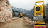
Theodolite (total positioning station) on a background of road construction in mountains#394349510
-
Selective focus of surveyor with blueprint and colleague using digital level on construction site#306406152

-
modern concrete and steel building construction site#670778241

-
state-of-th.e-art surveying equipment, 3D laser scanner, Engineering geodetic works with use of modern tools, monitoring, topography, construction.#690582837

-
Geography class web banner or landing page. Students learning#525284584

-
Important surveying on the construction site the foreman#143445591

-
Altitude geodesic mark. The metal structure on the plowed ground on a background of mountains, evening sky and sunset beams#216574200

-
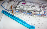
Construction plans with safety helmet#63191062

-
Construction engineers working on building site#751879783

-
Surveyor builder An engineer conducting surveying work at an outdoor construction site using theodolite transit equipment#782005313

-
A construction surveyor uses a theodolite to take measurements at a construction site.#771508044

-
A geologist uses technology to select soil as a sample. geodetic works.#729448314

-
White topography topology vector abstract background contour design#784327559

-
A black drone hovers over a golden wheat field in the rays of the setting sun. Concept: technologies in agriculture, the use of drones in agricultural technology and for crop monitoring.#764206883

-
geodetist and construction site, industry#40542075

-
план площадки#110060713
-
Architecture project building#16195298

-
Geological Symphony: Tectonic Rhythms. Concept Earthquakes, Plate Tectonics, Continental Drift, Seismic Waves, Volcanic Eruptions#783278127

-
stylist and royal Astronomy concept backdrop, space for text, photographic#774690042

-
Surveyor builder Engineer with theodolite transit equipment at construction site outdoors during surveying work#733487003

-
civil engineering flying drone over construction site survey for land and building project.#252175107

-
Comprehensive Depiction of KP Index Variation Over Time: A Colorful, Detailed Graph#771886897

-
modern concrete and steel building construction site#670778273

-
Surface logo template. Lined field abstract logo template. Abstract stripes line wavy field pattern. Topography logo. Relief logo. Mesh surface. Geology layers. Topographic line map.#382663231

-
Surveyor online service or platform. Land surveying, geodesy science#425526381

-
Important surveying on the construction site the foreman#143445864