777 873 281
Po - Čt 9-15h, Pátek 9-12h, So-Ne a státní svátky zavřeno
0
Žádné produkty
Bude determinováno
Doručení
0 Kč
DPH
0 Kč
Celkem
Ceny jsou s DPH
Produkt byl úspěšně přidán do nákupního košíku
Počet:
Celkem:
0 ks zboží.
1 produkt v košíku.
Celkem za produkty:(s DPH):
Celkem za doručení:(s DPH):
Bude determinováno
DPH:
0 Kč
Celkem(s DPH):
Výsledky vyhledávání členění
-
Bobonaro Municipality map, administrative division of East Timor. Vector illustration.#754869366
-
El Salvador outlined. OSM Topographic Humanitarian style map#705696849
-
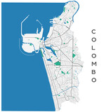
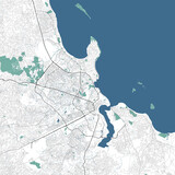
Colombo vector map. Detailed map of Colombo city administrative area. Cityscape panorama illustration. Road map with highways, streets, rivers.#523999724
-
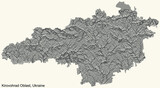
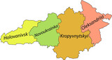
Topographic relief map of the Ukrainian administrative area of KIROVOHRAD OBLAST, UKRAINE with black contour lines on vintage beige background#496336019
-
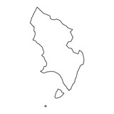
Map of the Province of Soria, administrative division of Spain. Vector illustration.#796488206
-
Map of the Province of a Almeria, administrative division of Spain. Vector illustration.#788270237
-
Hjorring Municipality map, administrative division of Denmark. Vector illustration.#785321798
-
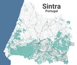
Sintra map, administrative area#638760390
-
Map of the Province of a Gipuzkoa, administrative division of Spain. Vector illustration.#792862591
-
Hedensted Municipality map, administrative division of Denmark. Vector illustration.#785316364
-
Guernsey map with administrative divisions. Vector illustration.#785268694
-
Saint Vincent and the Grenadines composition. Grayscale elevation map#722857989

-
Guam - USA composition. Grayscale elevation map#722856804

-
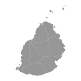
Mauritius map with administrative divisions. Vector illustration.#703897764
-
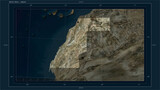
Western Sahara composition. High-res satellite map#703865112
-
Dar es Salaam map, city of Tanzania. Municipal administrative area map with rivers and roads, parks and railways.#593881061
-
Pastel flat vector map of raion areas of the Ukrainian administrative area of KIROVOHRAD OBLAST, UKRAINE with black border lines and name tags of its raions#496336012
-
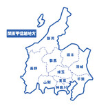
日本の地域図 関東甲信越地方 シンプル白地図#471417991
-
Chalan Pago Ordot municipality map, administrative division of Guam. Vector illustration.#772141396
-
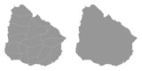
Uruguay map with administrative divisions. Vector illustration.#752239463
-
Ukraine between 2014 and 2022 outlined. Grayscale elevation map#713414161
-
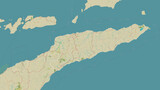
Timor Leste outlined. OSM Topographic Humanitarian style map#705696669
-
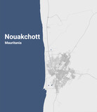
Nouakchott, Mauritania map. Detailed map of Nouakchott city administrative area. Cityscape panorama illustration. Road map with highways, streets, rivers.#598514550
-
Salzburg vector map. Detailed vector map of Salzburg city administrative area. Cityscape poster metropolitan aria view. Black land with white buildings, water, forest. White background.#539494883
-
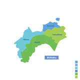
日本の地域図・日本地図 四国地方 雨の日カラーで色分けしてみた(英語版)#498178492
-
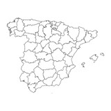
Spain map with administrative divisions. Vector illustration.#796501706
-
Pedernales Province map, administrative division of Dominican Republic. Vector illustration.#794992656
-
Herlev Municipality map, administrative division of Denmark. Vector illustration.#780540865

-
St Clement parishes map, administrative division of Jersey. Vector illustration.#775833595
-
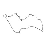
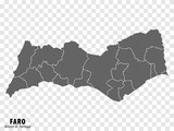
Map Faro District on transparent background. Faro District map with municipalities in gray for your web site design, logo, app, UI. Portugal. EPS10.#748637418
-
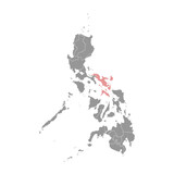
Bicol Region map, administrative division of Philippines. Vector illustration.#734915513
-
Andorra map with administrative divisions. Vector illustration.#716653205
-
Eswatini outlined. Grayscale elevation map#713413982
-
Cuba map with administrative divisions. Vector illustration.#698073005

-
Elias Pina Province map, administrative division of Dominican Republic. Vector illustration.#791633056
-
Kolding Municipality map, administrative division of Denmark. Vector illustration.#779733303
-
St Mary parishes map, administrative division of Jersey. Vector illustration.#775837276
-
Ukraine before 2014 outlined. Grayscale elevation map#713414148
-
Anguilla shape isolated on white. Physical elevation map#703865829
-
Germany composition. High-res satellite map#703863489
-
Belarus outlined. Low-res satellite map#698615849
-
North Hwanghae province map, administrative division of North Korea. Vector illustration.#695356686
-
Bulgaria - detailed map with administrative divisions country.#687221516
-
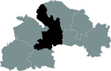
Black flat blank highlighted location map of the DNIPRO RAION inside gray raions map of the Ukrainian administrative area of Dnipropetrovsk (Sicheslav) Oblast, Ukraine#493035558
-
Monsenor Nouel Province map, administrative division of Dominican Republic. Vector illustration.#794988462
-
Varde Municipality map, administrative division of Denmark. Vector illustration.#787137878
-
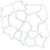
Map of Poland#781127082
-
Skanderborg Municipality map, administrative division of Denmark. Vector illustration.#779733162
-
Kalutara District map, administrative division of Sri Lanka. Vector illustration.#736076809
-
Ethiopia shape on white. Bilevel map#727961466