777 873 281
Po - Čt 9-15h, Pátek 9-12h, So-Ne a státní svátky zavřeno
0
Žádné produkty
Bude determinováno
Doručení
0 Kč
DPH
0 Kč
Celkem
Ceny jsou s DPH
Produkt byl úspěšně přidán do nákupního košíku
Počet:
Celkem:
0 ks zboží.
1 produkt v košíku.
Celkem za produkty:(s DPH):
Celkem za doručení:(s DPH):
Bude determinováno
DPH:
0 Kč
Celkem(s DPH):
Výsledky vyhledávání členění
-
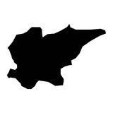
Black flat blank highlighted locator map of the Ukrainian administrative area of LUHANSK OBLAST inside gray flat map of UKRAINE#496552851
-
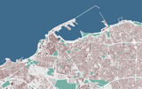
Jeddah vector map. Detailed map of Jeddah city administrative area. Cityscape urban panorama.#474242660
-
Odsherred Municipality map, administrative division of Denmark. Vector illustration.#796222095
-
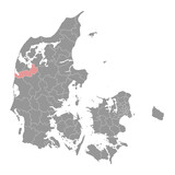
Horsens Municipality map, administrative division of Denmark. Vector illustration.#779733437
-
Tunisia map with administrative divisions. Vector illustration.#731738343
-
Türkiye shape isolated on black. Grayscale elevation map#703865756
-
Gordes is a rocky village and a small administrative area in Provence in the south of France.#683971836
-
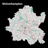
Wolverhampton city map, administrative area#627320535
-
Forest parishes map, administrative division of Guernsey. Vector illustration.#778864960
-
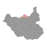
Ruweng Administrative Area map, administrative division of South Sudan. Vector illustration.#748612939
-
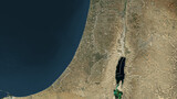
Palestine outlined. High-res satellite map#701211332
-
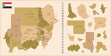
Sudan - detailed map of the country in brown colors, divided into regions.#680039314
-
Tripoli map. Detailed map of Tripoli city administrative area. Cityscape urban panorama. Outline map with buildings, water, forest.#591018966
-
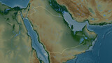
Saudi Arabia outlined. Physical elevation map#702124991
-
Ecuador with Galápagos Islands outlined. High-res satellite map#701210178
-
U.S. Virgin Islands - Saint Thomas shape isolated on white. High-res satellite map#698621585
-
Sharjah vector map. Detailed map of Sharjah city administrative area. Cityscape urban panorama.#580544502
-
Atom, the smallest constituent unit of ordinary matter that has the properties of a chemical element. Red-black tone effect#781707576

-
Vejen Municipality map, administrative division of Denmark. Vector illustration.#779733116
-
South Georgia - South Georgia and the South Sandwich Islands shape isolated on white. OSM Topographic Humanitarian style map#722868560
-
Northland Region map, administrative division of New Zealand. Vector illustration.#714662214
-
Istanbul map. Detailed map of Istanbul city administrative area. Cityscape panorama illustration. Road map with highways, streets, rivers.#542145233
-
Raleigh map. Detailed map of Raleigh city administrative area. Cityscape panorama.#431314511
-
Embu County map, administrative division of Kenya. Vector illustration.#796562958
-
Espaillat Province map, administrative division of Dominican Republic. Vector illustration.#791633073

-
Canary Islands - Spain shape isolated on white. High-res satellite map#698620470
-
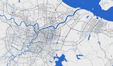
Prague map. Detailed map of Prague city administrative area. Cityscape panorama illustration. Road map with highways, streets, rivers.#577023252
-
Caracas map. Detailed map of Caracas city administrative area. Cityscape panorama illustration. Road map with highways, streets, rivers.#540648517
-
Port Louis vector map. Detailed map of Port Louis city administrative area. Cityscape panorama illustration. Road map with highways, streets, rivers.#515635738
-
Holstebro Municipality map, administrative division of Denmark. Vector illustration.#792818122
-
Suriname highlighted. Physical elevation map#758193667
-
Sipaliwini District map, administrative division of Suriname. Vector illustration.#720235950
-
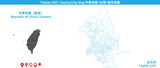
Taiwan Taoyuan vector map. Detailed map of Taoyuan city administrative area.#709559084

-
Taiwan Taipei vector map. Detailed map of Taipei city administrative area.#709558829
-
Scotland - Great Britain shape isolated on white. Bilevel elevation map#702122052
-
Izmir map. Detailed map of Izmir city administrative area. Cityscape panorama illustration. Road map with highways, streets, rivers.#543003746
-
Nairobi vector map. Detailed map of Nairobi city administrative area. Cityscape panorama illustration. Road map with highways, streets, rivers.#524936927
-
Detailed vector map poster of Wichita city Kansas administrative area. Blue skyline panorama. Decorative graphic tourist map of Wichita territory.#520665745
-
Kalundborg Municipality map, administrative division of Denmark. Vector illustration.#793825720
-
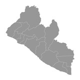
Liberia map with administrative divisions. Vector illustration.#701256563
-
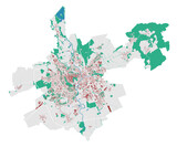
Brno map. Detailed map of Brno city administrative area. Cityscape urban panorama. Outline map with buildings, water, forest.#538306946
-
Sagamihara map. Detailed map of Sagamihara city administrative area. Cityscape panorama illustration. Road map with highways, streets, rivers.#537637216
-
Fredericia Municipality map, administrative division of Denmark. Vector illustration.#779733378
-
Ningbo map. Detailed map of Ningbo city administrative area. Cityscape panorama illustration. Road map with highways, streets, rivers.#535510589
-
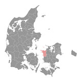
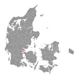
Fredericia Municipality map, administrative division of Denmark. Vector illustration.#791686030
-
Ecuador with Galápagos Islands composition. Grayscale elevation map#722856567
-
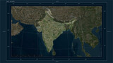
India composition. High-res satellite map#703863664
-
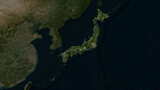
Japan highlighted. Low-res satellite map#698580307
-
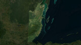
Belize highlighted. Low-res satellite map#698578882
-
Skopje vector map. Detailed map of Skopje city administrative area. Cityscape panorama illustration. Road map with highways, streets, rivers.#517406090